![]()
- info@mountadventureholidays.com
- +977 - 9843746611
![]()
Best season: March - May, September - November
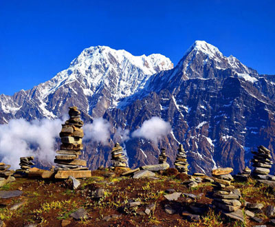
Dhaulagiri Circuit Trek in Nepal is a 14-day adventure that follows the Myagdi River Valley, starting in Beni and ending in Marpha. The trail covers 120 km, crossing cultivated fields, forests, and villages with ethnic groups like Gurung, Chhetri, and Magar. The trek includes crossing high passes such as the French Pass and Dhampus Pass, which can be physically demanding. The best time to trek is during spring and autumn, and it's important to have proper gear, acclimatization, and physical preparation. The trek ends in Marpha, a popular city in the Mustang district. Marpha is known for its apple orchards and beautiful scenery, making it a perfect place to unwind after the challenging trek. Trekkers can explore the narrow alleys lined with white-washed houses and visit the local monasteries. The bustling market in Marpha offers a variety of souvenirs and local handicrafts to take back home as a reminder of the incredible journey. Overall, the Dhaulagiri Circuit Trek is an unforgettable experience that showcases the natural beauty and rich cultural heritage of Nepal.
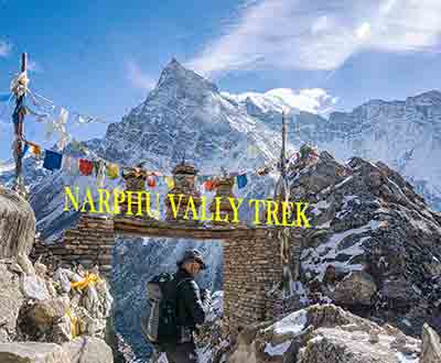
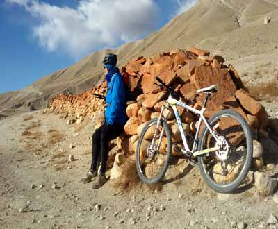
The trek includes high passes such as the French Pass and Dhampus Pass, making it physically demanding. The best time to trek is during spring and autumn, with the proper gear, acclimatization, and physical preparation. The trail ends in Marpha, a popular city in the Mustang district known for its apple orchards and beautiful scenery. Trekkers can enjoy unique cultural experiences, stunning natural landscapes, and the chance to witness traditional ceremonies and festivals. The environmental impact of trekking is also discussed, emphasizing the importance of responsible tourism practices to preserve the natural beauty of the Himalayas. Some trekkers choose to extend their journey by exploring other nearby villages, such as Jomsom and Kagbeni, before heading back to Pokhara. The local people in these areas are known for their hospitality and warmth towards visitors, offering a glimpse into their traditional way of life. Overall, the Annapurna Circuit Trek offers a challenging yet rewarding experience for those seeking adventure in the heart of the Himalayas. It is a journey that not only tests physical endurance but also provides a deep appreciation for the culture and environment of Nepal.
This morning we take a flight west to Pokhara, Nepal’s second largest town (820m) and make our way to our first night’s camp. On arrival we are greeted with sights of the entire Annapurna Range.We drive through pitch road until Beni and then off road after that. We make our way to Darbang (1110m) for the night; today’s journey takes approx. 6-7 hours.
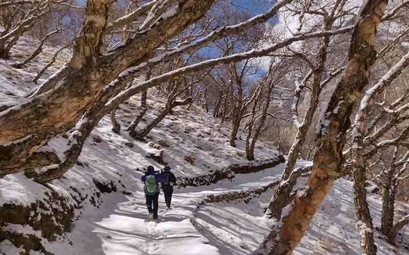
It is initially an easy walk as we follow the valley upstream but then we take a steeper route in the afternoon from the village of Phedi.The trail winds through conifer forests and then levels out as we head in to Dharapani.At this busy Magar village time can be taken to explore while camp is set in the schoolyard on the far side of the town. Dhaulagiri dominates to the northeast, while the Gurga Himal is to the northwest. MEALS: Breakfast, Lunch and Dinner
After crossing the river to its West Bank as you leave Phedi the trail starts climbing in earnest and there will be many switch-backs until you arrive at the ridge and the angle of ascent eases. Again the trail climbs steeply to the villages of Muri. Continue your trek to Sibang and Mattim. From here you continue up an incline to the snout of the ridge,descend to the Gatti Khola and reach Phalai Gaon (1810meters).Cross the Dhara Khola to once again emerge on the west bank of the Myagdi Khola and then climb a ridge to the large Magar village of Muri. MEALS: Breakfast, Lunch and Dinner
Descend a little, cross a stream and continue through terraced fields before climbing a ridge to reach the pass from where you can see Mt. Ghustung South (6465 meters).Descend to the Myagdi Khola and trek along its West Bank to the village of Naura from where you will climb a little before traversing a grassy hill and climbing a steep slope with switch-backs,then descend through a forest and terraced fields to Boghara (2080 meters). MEALS: Breakfast, Lunch and Dinner
The trail first descends through terraced fields to a small ridge, then through a forest to Jyardan which is the most remote permanent settlement in this part. After the settlement a high winding path crosses a rocky area which then descends before climbing again to Lipshe where there is on single hut.The trail continues through a forest to Lapche Kharka and then climbs to the level area at Dobang. MEALS: Breakfast, Lunch and Dinner
Firstly we descend to cross the Choriban Khola and trek through temperate forest.As we descend we enjoy glimpses of the west wall of Dhaulagiri, an inspiration for our efforts so far. We cross the Myagdi Khola and trek high above the river to Chartare. MEALS: Breakfast, Lunch and Dinner
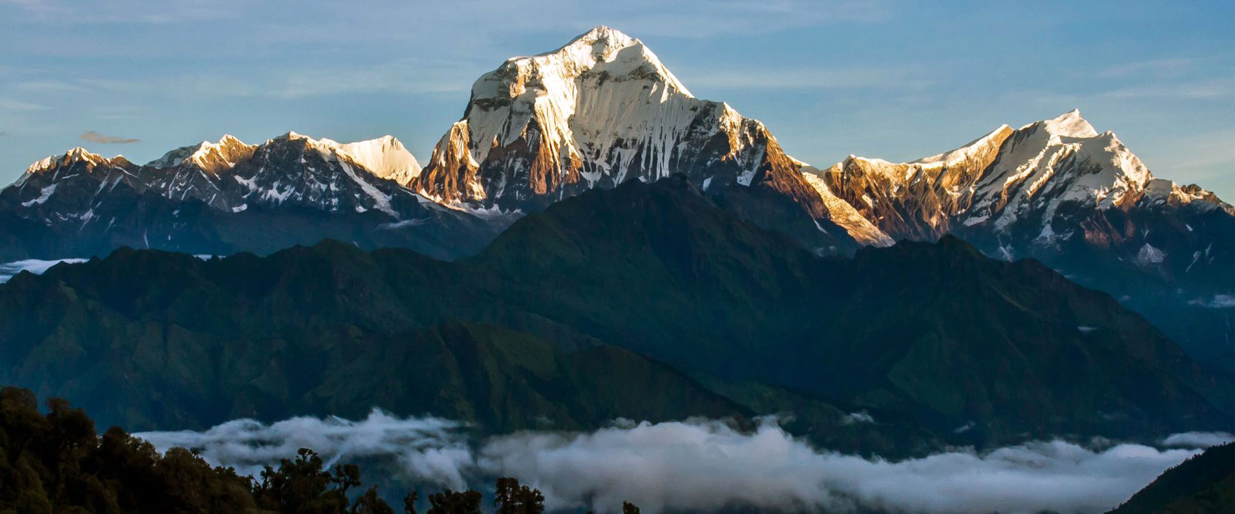
Our route takes us through the rhododendron and conifer forest and above the tree line.This is a short and very pleasant day’s walk.The southwest face of Dhaulagiri I looms above us and the snow-covered flanks of Manapati (6380m) rise to the south.The huge rock parapets of Tsaurabong Peak (6395m) are to our west and the huge peaks of Dhaulagiri II (7751m), Dhaulagiri III (7715m) and Dhaulagiri V (7618m) fill the western sky. MEALS: Breakfast, Lunch and Dinner
Today we will have a rest day and acclimatization day in Italian Base camp and explore the areas in the afternoon or evening .Overnight in Italian Base Camp.
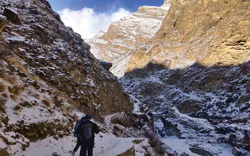
A very solid day of walking as we trek across the glacier and up towards the pass.The day commences with a gentle Walk across lateral moraine to the head of the Myagdi Khola and then on to the Chonbarban Glacier.As we round the bend of the valley,Tukuche Peak West is revealed for the first time.Our camp is spectacularly situated at the end of the glacier with views of Dhaulagiri I, II, III, V, Tukuche Peaks and the imposing icefall that cascades from the north east col of Dhaulagiri.
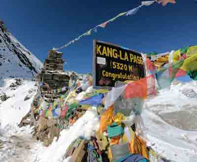
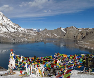
Our route leads off the glacier and ascends rocky scree to the pass. French pass is named after a French reconnaissance expedition in the 1950s which set out to climb an 8,000 metre peak. Dhaulagiri was chosen but found to be too difficult. Maurice Herzog and his team then attempted Annapurna I. Being the first to reach the summit of an 8,000m peak they achieved international acclaim. It was not without a high price though, as retold by Herzog in his book Annapurna I. As we approach the pass the terrain becomes steeper and it may be necessary to fix ropes for a small section, (approx 100m) depending on snow conditions. It will take at least half a day across undulating terrain to reach the pass from the Base Camp. As we reach our goal the mountains surround us; Sita Chuchura and Tukuche Peak West flank us, Dhaulagiri I is behind, and Mukut Himal and Tashi Kang are to the north. As we descend into Hidden Valley the landscape changes to stark, drylands with snowy peaks. There is a true sense of isolation here and it is quite possible we might sight the elusive blue sheep.
Another long day, depending on conditions, to our camp just below Thapa (or Dhumpus) Pass (5250m). It is a short climb to the pass (approx. an hour), followed by a long traverse and descent upon loose scree to our camp amongst vegetation once again.Now on the other side of the pass, we can enjoy frontal views of the Nilgiri range and the broad valley of the Kali Gandaki.
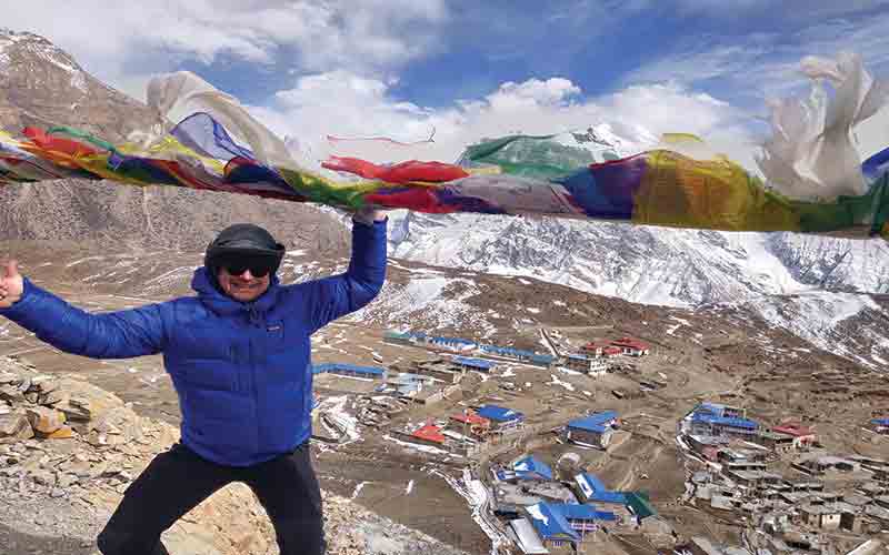
Descending towards the Kali Gandaki Valley, the trail through forest is well defined and makes a pleasant change from the high alpine terrain we have been in for the last few days. We descend steeply all day and enter the main trail for trekkers of the Annapurna Circuit. Marpha is a substantial town of the valley and a good stopping off point for trekkers/pilgrims and traders between Muktinath/Jomoson and Pokhara. The paved,winding footway and closely built terrace-like housing makes the town very picturesque. Many apples are grown in the area, there is a good chance we may have apple pie tonight!Continuing north we reach Jomsom and our lodge for the night. MEALS: Breakfast, Lunch and Dinner
We board the early morning flight to Pokhara savouring magnificent views of the Annapurna and Dhaulagiri ranges.On arrival at Pokhara airport we will have a couple of hours before the onward flight to Kathmandu.On arrival we transfer you to your hotel.
Today we drive to Kathmandu from Pokhara after having breakfast, we will reach the Kathmandu after approx 6-7 hour’s drive. Overnight in Kathmandu.


© Copyright 2026 Mount Adventure Holidays ,All rights reserved. | Developed by : Web Design In Nepal